ATTENTION: MONDAY IS A BIG DAY FOR RICHARDSON CYCLISTS!
There are two big bike events happening on Monday, June 2. Please try to attend either one, or both.

The first is the Ribbon Cutting Ceremony of the new Central Trail extension in Richardson. It’s a much needed extension of an existing trail, providing some great connections between our local DART rail train stations and neighborhoods. The City of Richardson and Dallas County are hosting a ribbon cutting ceremony to officially open the trail on June 2.
Here are the details:
Date: Monday, June 2. 2014
Time: 4:00 p.m.
Location: Spring Valley DART Station/Central Trail – Spring Valley Road at Lingco Drive
The next is the Bike Friendly Richardson, Bike Parking Initiative presentation to the Richardson City Council, that evening.
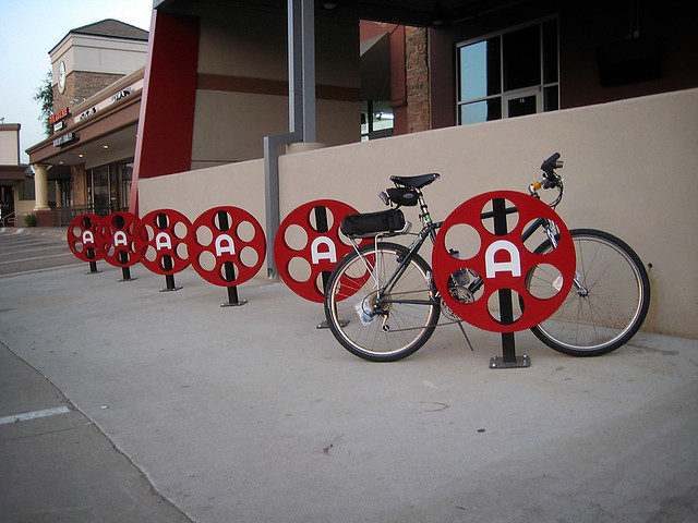
We were asked by City Council member, Scott Dunn, to present information about creating a functional and comprehensive bike parking plan that would benefit, not only cyclists, but local business owners as well as the city. Our new Bike Parking Initiative’s lead, Mark Adams, will present a brief introduction to a bigger plan that will, hopefully, pave the way to a system of well designed and well placed bike racks that will encourage more cycling around town.
Date: Monday, June 2. 2014
Time: 6:00 p.m. – During the City Council Work Session
Location: Richardson City Hall – 411 W Arapaho Rd, Richardson, TX 75083
WE NEED TO SHOW OUR SUPPORT FOR THESE EVENTS! Let’s try to get as many cyclists as possible to the ceremony and council meeting, and show our appreciation and support.
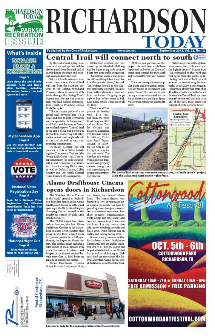
Central Trail Nearing Completion

According to last week’s city newsletter “Week In Review”, the Central Trail extension is nearing completion:
The expansion of the Central Trail is about 90 percent complete, and the City plans to celebrate its grand opening with a ribbon cutting June 2. The 1.9-mile southern expansion connects the 10-foot wide multiuse trail from the Arapaho Road DART Station to Richardson’s southern city limit. A future connection in the City of Dallas is expected to eventually tie it into the White Rock Creek Trail. The $4.5 million project is funded through Dallas County, $1.4 million from the City of Richardson’s 2010 Bond Program and Regional Tollway Revenue funds.
The City is also working to expand the Central Trail half a mile to the north to Richardson’s northern city limit. The existing trail ends at Renner Road, but the expansion will tie in to the CityLine development and eventually connect to the Plano trail system. The $1.8 million northern expansion is funded through Regional Tollway Revenue and the City’s Tax Increment Finance Zone #2. It is expected to be complete in the summer of 2015 and will allow the trail to run from city limit to city limit.
Watch a City Council work session presentation about progress on the Central Trail at bit.ly/1lDwyxu.
We can’t wait to ride this. It’ll be fantastic once cyclists are able to ride from the north end of town, eventually to the White Rock Creek Trail and into Dallas.
Comments Off on Central Trail Nearing Completion
More Progress On Central Trail South
This section is heading south to Spring Valley Station.
We’ve been following the progress on the Central Trail South (what we are calling the DART Trail section between Arapaho Road and 635 LBJ) and we are seeing some great progress. The last time we checked, the biggest barrier – which was building the trail over some creeks and drainage systems (between Belt Line Road and Spring Valley Road) – was requiring some major, time consuming construction.
From our latest inspection over the past weekend, we discovered that most of that construction is complete. All that remains, of the full trail extension, are just a few small pockets of missing trail, as well as the final, finishing touches. We’re hoping these are finished soon.
This section is covering the new drainage systems.
We’ve also discovered a new addition to the Central Trail south – trail construction NORTH of Arapaho. You may remember us pointing out the ‘gap’ in the original plans for the trail extension, back in 2010. We were concerned that the connection to the south extension was nothing more than a narrow sidewalk. We are glad that this issue was addressed and they are now continuing the wider trail from Arapaho Road, all the way to Arapaho Station. We would love to see that gap eventually connect to the north part of the Central Trail.
This is the new section north of Arapaho Road.
Comments Off on More Progress On Central Trail South
New Pics Of The Central Trail Construction – Buckingham To Spring Valley

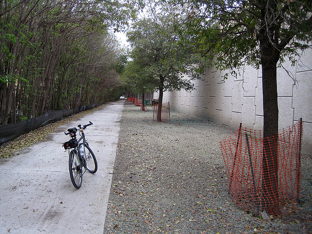
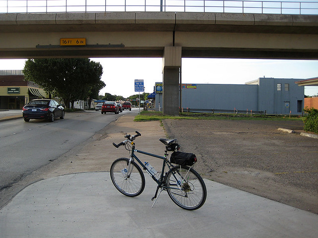
The Central Trail, southern extension – from Buckingham to Arapaho – is coming along nicely. The Central Trail goes north and south along the DART rail line which runs through Richardson. It will eventually connect Richardson, Plano and other suburban communities to the various parts of Dallas.
We’ve already posted pics of the ‘northern’ end of this extension that runs from Arapaho to Belt Line. Now, we’re seeing some great progress on the southern end, between Buckingham and Spring Valley. The trail isn’t officially open, so don’t head that way yet.
We’re not there yet. Even when complete, there is still a huge gap between Buckingham and the White Rock Creek Trail. Although more trail is needed to complete the connection, this Central Trail extension takes bicycle trail commuters one step closer. This is something DFW cyclists can get excited about. Here are some pics and observations.
This is the southern most end at Buckingham (facing north):

Here is the Spring Valley End (facing south):

Here is the Spring Valley End (image, not bike, facing north):

Here is the path along Spring Valley, heading to the signal crossing at Business Parkway. When we saw the plans for this, it originally seemed to be pretty narrow. It actually appears to be wider than a standard sidewalk. Without proper marking it may be confused as one.

Here is the trail connection on the north side of Spring Valley. As you can see, this is pretty wide and feels more like a multipurpose trail. This leads right into DART’s Spring Valley Station.

Comments Off on New Pics Of The Central Trail Construction – Buckingham To Spring Valley
The City of Richardson Talks About Their Trail Expansion
The City of Richardson is starting to realize that they need to really promote their bicycling friendliness. Over the past few years, they’ve made great efforts to improve awareness, expand the trail network and add traffic-calming bike lanes. However, aside from us at BFR and our cycling neighbors, folks in Texas rarely get to hear about it.
It seems like that is starting to change. Here is a video that they produced to promote the expansion of the Central Trail, along the DART rail line.
They are also talking about the expansion on the front page of the city’s monthly newsletter, Richardson Today. Here is a digital copy of that issue, featuring BFR friend and local cyclist, Marshall Hallberg.
Comments Off on The City of Richardson Talks About Their Trail Expansion
Updated Pics Of The Central Trail (South) Construction
Here are some updated pics of the new, southern link to the Central Trail.


Construction is still looking a bit light, south of Belt Line. We’ll keep you posted on any new updates.
Comments Off on Updated Pics Of The Central Trail (South) Construction
Central Trail Construction (South) Coming Along Nicely
We’ve been keeping an eye on the construction of the southern extension of the Central Trail.
Central Trail is the trail that runs parallel to Central Expressway, along the DART Rail Red Line tracks. Currently, it starts at Renner Road at Routh Creek Parkway (where it connects to the Spring Creek Trail), and runs south to DART’s Arapaho Center Station – well, sort of. In our opinion, it really stops at about Alma Road, and becomes a sidewalk, along Greenville, until it reaches Arapaho Center Station. Read more about that here.
This new addition is designed to extend Central Trail south, from Arapaho Road to Buckingham Road – at the city limit. Future extensions will eventually connect it to the White Rock Creek Trail. We were also given some information that lead us to believe that the trail extension will connect to the Arapaho Center Station train platform, instead of the bus transfer station on the east side of Greenville Road. That would be fantastic if it actually happens.
Once this extension is complete, people will be able to walk or ride their bikes to three of the four DART train stations in Richardson (Spring Valley, Arapaho Center and Galatyn Park). The Bush Turnpike Station will have to wait for a future extension.
Here are some pics and descriptions of the current progress:
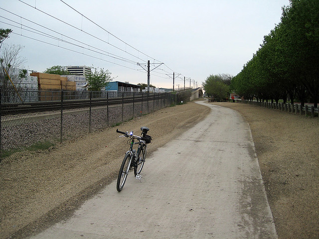
This shot was taken at the southwest corner of Arapaho Road And Greenville Avenue. You can see the DART tracks to the right and Greenville Avenue to the left.

This shot was taken a bit further south along Greenville Avenue. As you can see, they’re making every effort to save the trees.

This shot was taken even further south along Greenville Avenue. Here you can see how the trail will coexist with the DART Red Line.

This pic was taken just south of the Jackson Street crossing.

As you can see, the trail isn’t ready to ride.

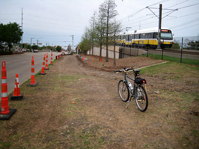
As the trail approaches Belt Line Road, it actually crosses under the DART Rail track overpass.

This is where the trail will cross Belt Line Road. The city has decided that the light at Interurban will be the best place to cross.

Once across Belt Line Road, the trail is lost at this parking lot entrance. It eventually begins again at the rail underpass.
The trail construction seems to end at Polk Street.

I rode a bit further south to find this bridge being built at Phillips Street. Not seeing a current plan, I can only guess that this will have a roll in the extension of Central Trail.

I didn’t get a chance to ride down to Spring Valley Station. I’ll try to get down there next weekend to check on any progress down there.
Comments Off on Central Trail Construction (South) Coming Along Nicely
Richardson City Council Awards Bid for Central Trail Construction

From the City of Richardson weekly newsletter:
The City Council on Monday awarded a bid of $3.4 million to Ed Bell Construction Company to extend the Central Trail 1.9 miles from the Arapaho Road DART Station to the southern city limit. Construction of the 10-foot wide concrete multiuse trail is expected to begin in April and last for about one year.
The $4 million project is funded through Dallas County and the City of Richardson’s 2010 Bond Program. The lowest bid to construct the trail came in about $400,000 over budget, so the City removed some amenities such as irrigation systems, landscaping, and benches to be constructed in a possible second phase at a future date. The City also hopes to use $600,000 in Regional Tollway Revenue funds awarded for the Central Trail to help enhance the project.
The Central Trail currently runs from the Spring Creek Trail in north Richardson and ends at the Arapaho Road DART Station. The extension will run alongside the DART rail line and is planned to eventually connect with the Richardson city limit to the south and a future connection to the Dallas’ White Rock Creek Trail.
Watch the City Council presentation at http://bit.ly/V6oiYQ.
We are extremely excited that this is happening and we’d still like to see the small gap in the plan addressed.
Comments Off on Richardson City Council Awards Bid for Central Trail Construction
Richardson City Council Receives Update on Central Trail

From the City of Richardson‘s weekly newsletter:
The City Council received an update Monday on the extension of the Central Trail, which runs from the Spring Creek Trail in north Richardson and currently ends at the Arapaho Road DART Station. Plans call for the trail to extend to Richardson’s southern city limit and eventually connect with Dallas’ White Rock Creek Trail.
The City expects to begin construction on the trail in January and complete the project in early 2014. The 1.9-mile extension will cost $4 million and is funded through Richardson’s 2010 Bond Program and Dallas County.
Watch the work session presentation at http://bit.ly/P8H54b.
We’re pretty excited about this extension and what it would mean for connecting the east side of Richardson to the White Rock Creek Trail (although the current plan doesn’t extend that far, just yet). This would make commuting into Dallas – via multi-purpose trails – pretty easy.
We still have our reservations of how the trail is planned just north of Arapaho, connecting to the Arapaho DART station and the existing portion of the trail to the north. So far, it’s just a narrow sidewalk and there are no plans to re-route or widen it. Click here to see our post on this.
Comments Off on Richardson City Council Receives Update on Central Trail
We’d Like To Address A Small Gap In The Central Trail Plan

Here's Where The Good Trail Ends
We are very fortunate to have such an aggressive Bike and Pedestrian Plan in Richardson. The city planners are doing a great job retrofitting some new trails and bike lanes into an older, built-out infrastructure.
In that plan is the Central Trail, which will provide passage through Richardson. When completed, it will run through the central part of town, along the DART Rail Red Line, giving us, and all of our northern neighbors, a nice connection to the Dallas trail network.
Earlier this month, the City of Richardson presented the first draft of their plan to continue the Central Trail further south. Right now, the only existing part runs from Renner Road (patched through the Spring Creek Trail until it connects at Glenville Drive) to Arapaho Road. The new plan shows how the trail will continue from Arapaho Road, south towards Buckingham Road.
Although it’s a great plan, we feel that there are usability gaps within the existing part of the Central Trail that should be addressed as well. The following is our evaluation of the the part just south of Campbell Road and how we think it can be improved.
THE CURRENT TRAIL:
If you’ve walked or biked this part of the trail, you’ll be familiar with our references. Technically, the trail is complete from Campbell Road to Arapaho Road, which is why this section is not in the current extension plan. The concerns we have are with some minor aesthetics as well as some issues with usability that hinder the trail from being a complete success.

See The Rough Parts Of The Existing Trail
First, the minor aesthetics. About a third of a mile south from Campbell Road, you’ll note that the nicely paved trail ends. From there it becomes rough, narrow and overgrown with grass. This rough patch continues across and down the east side of Greenville Avenue until it reaches the Tecktronics parking lot at Collins Boulevard.

Rough Part Of The Trail
We realize that this is nitpicking, but if the City is spending the money to continue the trail, they should look into completing the trail experience by matching the rest of the trail.
Next is trail usability. Because of limited real estate next to the DART tracks, you can see why the trail jumps to the other side of Greenville Avenue. Since this trail leads to the DART Arapaho Station entrance, which is on the east side of Greenville Avenue, we’re okay with that. Considering the limitations in the existing infrastructure, we also understand how the trail runs narrow in some parts.

Trail - a.k.a. Sidewalk Just South Of Woodall Drive
Our bigger concern is when the trail passes just south of the Arapaho DART Rail station. After the trail crosses Woodall Drive, it becomes a glorified sidewalk all the way to Arapaho Road. Here it’s too narrow for multi-use traffic. To make this worse, the shrubs along this part of the trail are overgrown and blocking even more space. In our opinion, this becomes a gap in the trail plan.
WE PROPOSE THIS SOLUTION:
Since the current plan to continue the Central Trail south from Arapaho Road starts on the WEST side of Greenville Avenue, perhaps we should look at crossing Greenville at Woodall Drive instead of Arapaho Road. This makes sense for a few reasons.

Click To See Our Suggested Solution
Let’s talk space. As mentioned, the limitations of real estate made sense to pull the trail to the east side of Greenville Avenue. This becomes less true at Woodall Drive. There is actually more space on the west side of Greenville Avenue at this point — plenty of space for a wider trail.

Wider West Side Of Greenville
Let’s talk convenience. If you put a crossing at Woodall Drive and continue the trail from there, connecting the new new addition of the Central Trail (which is planned to start on the west side of Greenville Avenue) becomes more seamless.
Let’s talk safety. The current plan is to get trail traffic to cross the intersection at Greenville Avenue on the north side of Arapaho Road, and then cross Arapaho Road on the west side of Greenville Avenue. From experience, we know this to be an extremely busy intersection with lots of auto traffic coming from multiple directions. We feel that reducing the crossings at this intersections to just one would help with safety.
We realize that putting a crossing on Greenville Avenue, at Woodall Drive – an intersection not protected by traffic lights – might seem less safe. However, the trail already crosses Greenville Avenue – further north at Alma Road – under the same traffic conditions. If it’s safe enough at Alma Road, why not at Woodall Drive. In fact, we feel it’s easier for crossers to watch for auto traffic in just two directions instead of the many at Arapaho Road.

Trail Crossing Greenville Avenue at Alma Road
WHAT DO YOU THINK?:
Of course, this is all based on seat-of-our-pants, traveled experience on this trail and we haven’t pulled any statistical data that supports this as a better solution. We’d love to hear what you think about this. IF you’ve been on this part of the Central Trail, we’d like to hear your opinion on our solution and/or what you would do differently.
Click here to see a map.
Click here to see more shots.
Comments Off on We’d Like To Address A Small Gap In The Central Trail Plan


Comments Off on ATTENTION: MONDAY IS A BIG DAY FOR RICHARDSON CYCLISTS!